
Browse
Here is the problem: looking at a map of a place is nothing like actually being there. The same is true when looking at a photograph or reading a story – but in the case of a map, it comes with the illusion of completeness, of control.
This has always been the case and has been addressed by everyone from 19th century poet Baudelaire to 20th century geographer Yi Fu Tuan. But something insidious is happening with modern digital maps with the way they are becoming more and more photorealistic, the accelerating update cycle and the networked information streams bringing them closer and closer to real-time. Especially when you consider live navigation apps, the boundary between a map and a videogame or a live-streaming video is growing increasingly blurry. In some cases they have already become one and the same. This development naturally leads to a sense that we are growing closer to direct, unmediated knowledge of a place, more connected to the way things really are. Just consider the uptick in the numbers of virtual tourism startup companies…
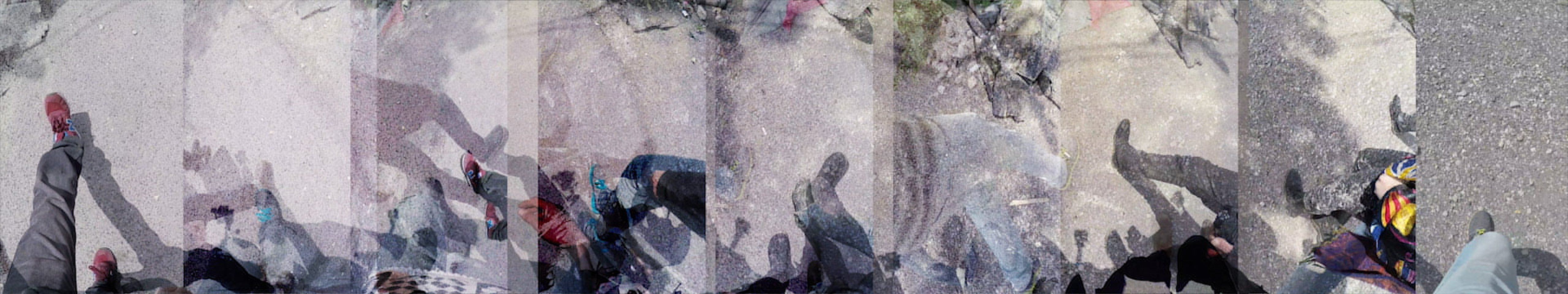
But of course, all we are getting with these tools is an amplified singular, top down perspective. The same perspective used by surveillance drones and municipal zoning boards. A monolithic, inhuman view with no memory and no acknowledgment of the ridiculous patchwork of information from which it is constructed. No acknowledgement that the reality of place is to be found in the network of connections, relationships and histories that populate it. No recognition of the human bodies that make up the nodes in this network, just as much as the roads do. Bodies that experience a place by moving through it, sensing it, experiencing the push of the street surface against their feet, the force that their body exerts back, the rhythm generated by the feedback loop between the two.
But the same technology that is constantly being driven by the military-industrial complex towards a singularity of maximum efficiency, may be used to create a different representation of place. One that is not conceived of as a tool for production, but as an intentionally partial expression of human experience. So let there be other kinds of techno-maps, a broken, wonderfully inefficient digital cartography. Let there be:
Living maps
Maps that contradict themselves
Maps with memories, often false
Cubist maps
Maps that overlap and argue
Maps that have a conversation
Maps that drink
Maps that construct spaces
Maps that deconstruct places
Shapeshifting, multi-limbed maps
Tender maps
Maps that stay alive
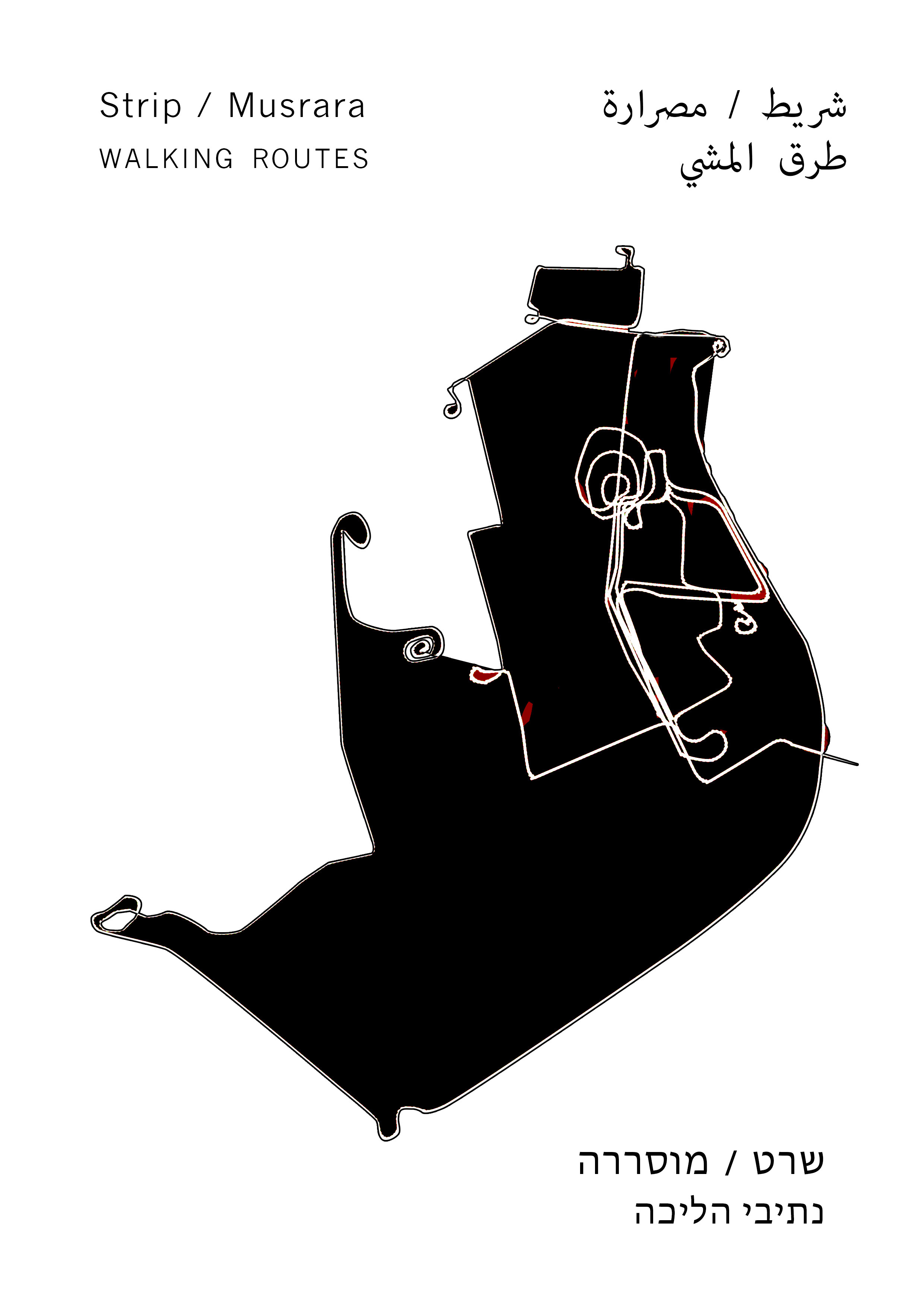
On Musrara
Musrara is a neighborhood with few roads but many alleys, back passages and stairways, near the seam between east and west Jerusalem, Palestine and Israel. It was originally built by wealthy Palestinian families during Ottoman times, all of whom fled in the war of 1948 when it became a frontier zone on the Israeli side of the Israeli-Jordanian border. In the 1950s, newly arrived Sephardic Jewish immigrants from Morroco were sent there by the Israeli government to occupy the abandoned houses that were turned into multi-family squats in the sensitive border-zone. Many lived there in cramped spaces, in abject poverty with poor infrastructure, facing constant discrimination from the European dominated establishment. The conditions and rising political awareness in the neighborhood led to the formation of the Israeli Black Panther movement that promoted radical ideas about wealth redistribution, anti-racism, and Arab-Jewish solidarity, whose impact on the neighborhood and the country resonates to this day. Today the neighborhood is dealing with an aging Moroccan population, an influx of ultra-orthodox religious families, and an impending wave of gentrification. In between are a range of inhabitants, from European monks to Palestinians in transit to and from neighboring East Jerusalem, to Israeli art students. Musrara is extremely layered with history, politics, and (often contradictory) memories, while at the same time being nearly unmappable in the traditional sense.
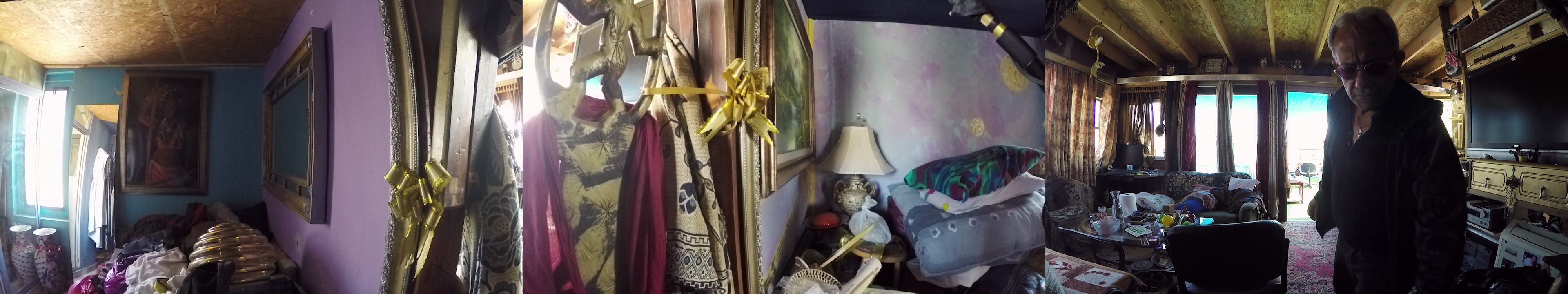
1. Transcript from a monologue by Coco Deri: former Black Panther, organizer and artist
Over here is where the history of the struggle and of my life in general began from age 10, or 11. And from here it started growing in a process of continuation, of development.
My development: physical, ideological, all the stages, the chain of development in the life of a man.
After that, you continue. You go out, you all go out to a place, now you see a picture that, up until ’67, until the war,(註1) you couldn’t even stand here. Here, is where from the dawn of history was formed, designed, initiated all the religions, the three big religions: Christianity… Islam and Judaism. And to this day Islam and Judaism are really close: The Temple Mount and Al-Aqsa. And Christianity always looked on from the side. And here you’re seeing all of this in a picture, so that if some alien from another planet came here, and you show it this view then it can immediately understand the conflict, and all that’s going on here.
Everything here has meaning, or exposes something. When you see something beautiful, then you feel, it causes you excitement. This excitement causes a whirlwind of emotion, a caressing of the soul. Now, this wall – this is how I grew up, in this sort of home. I put this painting up just to create contrasts. What I mean is, this painting is colorful, pretty, special. And the painter who made it is an artist. A person who paints like this is someone who sees life in a more beautiful way. And back then, we grew up without colors, in a life of black and white and gray.
We used to live in ruins, so this wall always reminds me of my childhood – when I look at it, I see a movie of my life. Everything was peeling. If we go outside I can show you another wall, that will demonstrate this.
You know, in four months I’ll finally be a grandpa. So I need to… prepare.
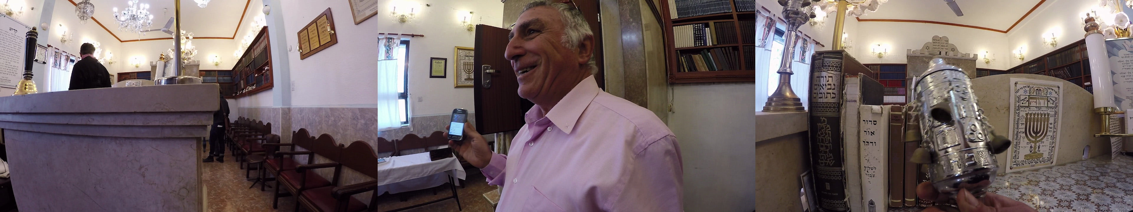
2. Transcript from a monologue by Rafi Ochayun: Former Black Panther, poet, parking lot attendant and caretaker of a local synagogue
This synagogue was here more than 60 years I think, since 1948.(註2) There’s no shortage of synagogues in this neighborhood, but they’re all emptying out. In the new neighborhoods they have an opposite problem: lots of people and no synagogues.
This is all stuff that I wrote:
I am a functional subject, of a dysfunctional system
Is this the Land of the Jews, or the Land of All its Citizens, that is the question!
And by the way, how do you define who is Jewish?
Our hope is not yet lost.(註3) Together we will battle racism,
we will promptly deport all undocumented migrants
In the name of enlightened government.
The glass ceiling must be broken!
It’s time for a Sephardic Prime Minister,
fifty percent of the population deserves a voice.
The Black Panthers are back, big time, you’ve been warned –
a new set of priorities is here.
Now you’re entering the real Musrara! Musrara of the houses, the synagogues, the diversity of people. Not the scary way it was portrayed on TV when the Black Panthers were around in the 70s. I think I properly express what I sense from our ruling class, and this is what I write on a daily basis, sitting in the parking lot each day, and then passing my poems to Avi Sabag.
When I was a kid I grew up in Musrara, but I went to Rehavia(註4) to attend the youth movement. One of the girls there went to her brother’s graduation ceremony from Airforce-pilot training. So one of the boys asked her, “how many negroes were there?” and I didn’t know what he was asking her. So I asked him, “what are negroes?” He said “no, we were just joking between us…” But I knew he meant Sephardic Jews like me. These boys and girls, they’re the same people that these days are the senior doctors and judges and leaders. The cream of the crop, the elites of Israeli society. And me, I finished college at age forty five, and I was referred to in school as a “damaged intelligence”. The person who called me that, I think he has some brain damage himself.